ALL 19 MUNICIPALITIES
Discover detailed information about each municipality of the Azores, including economic sectors, tourist attractions, history and unique characteristics.
19 municipalities found
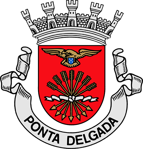
São Miguel
Population
69,038
Area
233 km²
Parishes
24
💰 Economic Data
Purchasing power 103.61% of the Azores average (2013)
🏭 Economic Sectors
Services, Commerce, Tourism, Industry, Agriculture (Dairy)
🎯 Tourist Attractions
Portas da Cidade, Forte de São Brás, Igreja de São Sebastião, António Borges Botanical Garden, Lagoa das Sete Cidades, Whale watching
📜 History
Ponta Delgada was elevated to city status in 1546, after the original capital Vila Franca do Campo was destroyed by an earthquake. The 19th century was the 'golden age' thanks to prosperity from the orange trade with the United Kingdom.
✨ Interesting Facts
Largest municipality and executive capital of the Autonomous Region of the Azores. The main economic center and gateway through the international airport and port.
Mayor & Contact
Mayor
Pedro Nascimento Cabral
Political Party
PSD
In office since
2021
Parishes (25)
Population
15,130
Area
46 km²
Parishes
5
💰 Economic Data
€14,090 per inhabitant (2022)
🏭 Economic Sectors
Services (76.8%), Industry and Construction (17.0%), Agriculture, Fishing and Livestock (6.1%)
🎯 Tourist Attractions
Municipal Swimming Complex, Caloura (fishing village and natural pools), Cerâmica Vieira (traditional ceramics), Porto dos Carneiros, Igreja de Nossa Senhora do Rosário
📜 History
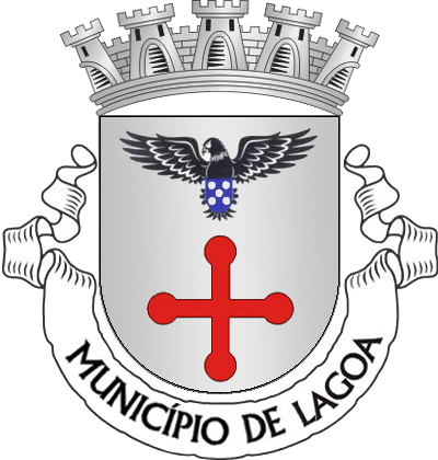
Lagoa was settled shortly after the discovery of São Miguel in 1427 and received 'vila' status in 1522. It was an important agricultural center and exported oranges in the 19th century. In 2012, Lagoa was elevated to 'cidade'.
✨ Interesting Facts
Strong industrial vocation with factories for ceramics, alcohol, vegetable oil, soap and animal feed. Growing tourist and residential center on the south coast.
Mayor & Contact
Mayor
Frederico Furtado de Sousa
Political Party
PS
In office since
2025
Parishes (5)
Population
32,397
Area
180 km²
Parishes
14
🏭 Economic Sectors
Agriculture (livestock and dairy farming), Tourism (surfing, hot springs), Industry
🎯 Tourist Attractions
Chá Gorreana Tea Plantations, Caldeira Velha (hot springs), Praia do Areal de Santa Bárbara (beach), Salto do Cabrito (waterfall)
📜 History
Ribeira Grande officially received city rights in 1507. The city was severely affected in 1563 by a volcanic eruption of Pico do Sapateiro. In 1981, Ribeira Grande officially received city status.
✨ Interesting Facts
Surf capital of the Azores due to the excellent waves at Praia do Areal de Santa Bárbara. Home to the oldest and currently only tea plantation in Europe, Chá Gorreana.

Mayor & Contact
Mayor
Jaime Vieira
Political Party
PSD
In office since
2025
Phone
+351 296 470 730Address
Largo Conselheiro Hintze Ribeiro, 9600-509 Ribeira Grande
Parishes (13)
Population
10,368
Area
78 km²
Parishes
6
💰 Economic Data
$23,200 (PPP) per capita (2013)
🏭 Economic Sectors
Tourism (whale watching, diving, water sports), Agriculture (pineapples, oranges, dairy), Fishing, Commerce
🎯 Tourist Attractions
Ilhéu de Vila Franca do Campo (nature reserve and volcanic crater), Ermida de Nossa Senhora da Paz (chapel with panoramic view), Marina, Praia da Vinha da Areia
📜 History
Vila Franca do Campo was the first capital of São Miguel until the devastating earthquake of 1522. After the earthquake, the capital was moved to Ponta Delgada. The city later recovered through the cultivation of oranges and pineapples.
✨ Interesting Facts
Birthplace of explorer Bento de Góis. First municipality on São Miguel with electricity (1900). The name means 'Free City of the Field'.

Mayor & Contact
Mayor
Graça de Fátima Bolarinho Ventura Melo
Political Party
PS
In office since
2025
Parishes (7)
Population
5,883
Area
108 km²
Parishes
6
🏭 Economic Sectors
Agriculture (historically 'Granary of the Earth'), Fishing, Tourism
🎯 Tourist Attractions
Furnas Valley (fumaroles, hot springs and Lagoa das Furnas), Parque Terra Nostra, Poça da Dona Beija, Miradouro do Salto do Cavalo, Wheat Museum
📜 History
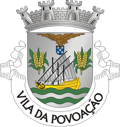
Povoação is the location where the first settlers of São Miguel island landed in 1444, under the leadership of Gonçalo Velho Cabral. The municipality was founded in 1839 and was known as the 'Granary of the Earth' until the 20th century.
✨ Interesting Facts
Known for the 'Seven Lombas' (hills): Cavaleiro, Carro, Botão, Pomar, Pós, Alcaide and Loução. The local culinary specialty is the 'Fofa de Povoação', a type of filled éclair.
Mayor & Contact
Mayor
Pedro Nuno Sousa Melo
Political Party
PS
In office since
2021
Parishes (6)
Population
4,439
Area
100 km²
Parishes
9
🏭 Economic Sectors
Agriculture, Livestock (cattle, pigs, poultry), Forestry, Tourism, Crafts
🎯 Tourist Attractions
Miradouro da Ponta da Madrugada, Miradouro da Ponta do Sossego, Farol do Arnel (oldest lighthouse in the Azores), Pico do Bartolomeu, Parque Natural da Ribeira dos Caldeirões
📜 History
The municipality of Nordeste was settled in 1444, shortly after the discovery of São Miguel island in 1427. The economy was historically based on the cultivation of wheat, sugarcane, woad and later oranges.
✨ Interesting Facts
Known as the most flowery municipality in the Azores. Location of the Priolo Environmental Center, dedicated to the protection of the rare Azores bullfinch (Priolo). Best place to see the sunrise.

Mayor & Contact
Mayor
António Miguel Borges Soares
Political Party
PSD
In office since
2013
Parishes (9)
Terceira
Population
33,701
Area
239 km²
Parishes
19
💰 Economic Data
Annual turnover €603 million (2020), 12.8% of the Azores region
🏭 Economic Sectors
Tourism, Agriculture (dairy and livestock), Commerce, Services, Construction, Agri-food
🎯 Tourist Attractions
Monte Brasil, Duke of Terceira Garden, Sé Cathedral, Fortaleza de São João Batista, Palácio dos Capitães Generais, Alto da Memória, Algar do Carvão
📜 History
The city, founded in 1478, was a mandatory stopover for fleets during the Age of Discovery and played a crucial role in trans-Atlantic trade. The historic center has been on the UNESCO World Heritage List since 1983.
✨ Interesting Facts
UNESCO World Heritage Site due to its unique Renaissance street plan and military architecture. The first European city in the Atlantic Ocean and the first capital of the Azores.

Mayor & Contact
Mayor
Fátima da Conceição Lobão Santos
Political Party
PS
In office since
2025
Parishes (18)
Population
19,862
Area
161 km²
Parishes
11
🏭 Economic Sectors
Service sector (Lajes Air Base), Tourism, Commerce, Port activities, Agriculture (dairy products)
🎯 Tourist Attractions
Serra do Cume Viewpoint, Vitória Beach, Miradouro Do Facho, Historic Center, Praia da Vitória Marina, Fort Santa Catarina
📜 History
The municipality was originally founded as Vila da Praia around 1456. After the victory of the Liberals over the Absolutists in the Naval Battle of Praia in 1829, the name was changed in 1837 by Queen Maria II to Praia da Vitória (Beach of Victory).
✨ Interesting Facts
Home to Lajes Air Base, an important military base of the United States and Portugal. One of the few sandy beaches on Terceira and an important commercial port.

Mayor & Contact
Mayor
Vânia Ferreira
Political Party
PSD
In office since
2021
Phone
+351 295 540 200Address
Praça Francisco Ornelas da Câmara, 9760-851 Santa Cruz
Parishes (11)
Faial
Population
14,466
Area
173 km²
Parishes
13
🏭 Economic Sectors
Tourism, Maritime services (marina), Agriculture, Fishing, Blue Economy (Ocean Sciences)
🎯 Tourist Attractions
Horta Marina, Peter's Café Sport, Caldeira do Faial, Capelinhos Volcano, Praia do Porto Pim, Capelinhos Volcano Interpretation Center
📜 History
Horta was an important hub for trans-Atlantic shipping, first for whalers and later for submarine communication cables. The city was elevated to city status in 1833 and is the legislative capital of the Azores.
✨ Interesting Facts
The Horta marina is a famous stop for trans-Atlantic sailors, who decorate the walls and pontoons with paintings for good luck. The city is known as the 'Sea City' and Faial island as the 'Blue Island' due to the hydrangeas.

Mayor & Contact
Mayor
Carlos Manuel da Silveira Ferreira
Political Party
PSD/CDS-PP/PPM
In office since
2021
Parishes (12)
Pico
Population
4,398
Area
155 km²
Parishes
6
🏭 Economic Sectors
Primary sector (livestock for milk and meat), Commerce, Services, Agriculture, Tourism (whale watching)
🎯 Tourist Attractions
Museu dos Baleeiros, Centro de Artes e Ciências do Mar, Forte de Santa Catarina, Lagoa do Paul, Mistério de São João, Furna da Malha (lava tunnel), Whale watching
📜 History
Lajes do Pico was historically the center of whaling in the Azores, an activity that dominated the economy and culture of the municipality for more than a century. Whaling ended in the early eighties.
✨ Interesting Facts
Home to the Museu dos Baleeiros (Whalers Museum) and the Centro de Artes e Ciências do Mar, housed in the former whale processing factory. Important whale watching center.

Mayor & Contact
Mayor
Ana Catarina Terra Brum
Political Party
PS
In office since
2021
Phone
+351 292 679 700Address
Rua de São Francisco, Convento de São Francisco, 9930-135 Lajes do Pico
Parishes (6)
Population
3,461
Area
142 km²
Parishes
5
🏭 Economic Sectors
Whaling (historical), Fishing, Agriculture (especially viticulture), Tourism
🎯 Tourist Attractions
Museu da Indústria Baleeira (Whaling Museum), Lagoa do Capitão, Natural pools of São Roque do Pico, Convento de São Pedro de Alcântara, Cais do Pico
📜 History
The municipality was founded in 1542, split from Lajes do Pico. The economy was strongly influenced by whaling, with five factories along the coast for processing whales into oil and fertilizers, until the eighties.
✨ Interesting Facts
Home to the Fábrica das Armações Baleeiras Reunidas, now a museum, documenting the history of whaling on the island. The municipality covers the north coast of the island and extends to the summit of the Pico stratovolcano.

Mayor & Contact
Mayor
Luís Filipe Silva
Political Party
PSD
In office since
2021
Phone
+351 292 648 700Address
Alameda 10 de Novembro de 1542, 9940-353 São Roque do Pico
Parishes (5)
Population
6,559
Area
147 km²
Parishes
6
🏭 Economic Sectors
Agriculture, Viticulture (wine production), Tourism, Fishing (tuna canning), Construction
🎯 Tourist Attractions
Wine Museum (Museu do Vinho), UNESCO Vineyards of Criação Velha, Natural Pools of Criação Velha, Gruta das Torres (largest lava cave in Portugal), Pico Mountain (climbing)
📜 History
Madalena's identity has been shaped by wine and the sea since the 15th century. In the 18th century, whaling was dominant, but after its disappearance, the municipality reinvented itself by preserving wine traditions.
✨ Interesting Facts
Known as the 'Capital of Azorean Wine'. The vineyards of Criação Velha, characterized by unique basalt stone walls, are on the UNESCO World Heritage List. The municipality lies at the foot of the Pico volcano, the highest mountain in Portugal.

Mayor & Contact
Mayor
Catarina Isabel Gaspar Manito
Political Party
PSD
In office since
2025
Parishes (6)
Santa Maria
Population
5,504
Area
97 km²
Parishes
5
💰 Economic Data
Total business turnover: €60,152,000 (2022)
🏭 Economic Sectors
Service sector, Tourism, Agriculture, Fishing
🎯 Tourist Attractions
Praia Formosa, Miradouro de São Lourenço, Forte de São Brás, Igreja Matriz de Nossa Senhora da Assunção, Ermida dos Anjos Chapel, Gonçalo Velho Lighthouse, Barreiro da Faneca
📜 History
Vila do Porto is the oldest municipality in the Azores, with a charter from 1470. Explorer Christopher Columbus visited the island in 1493 on his return journey from America. The international airport is one of the oldest in the Azores.
✨ Interesting Facts
Santa Maria is the only island in the Azores with a Mediterranean microclimate and sandy beaches. The island has the most sunshine in the Azores. The 'red desert' Barreiro da Faneca is a unique geological phenomenon.

Mayor & Contact
Mayor
Bárbara Pereira Torres de Medeiros Chaves
Political Party
PS
In office since
2021
Phone
+351 296 820 000Address
Largo Nº Srª da Conceição 9580-539 Vila do Porto Santa Maria - Açores - Portugal
Parishes (5)
São Jorge
Population
4,949
Area
117 km²
Parishes
6
🏭 Economic Sectors
Agriculture (dairy farming and cheese production), Tourism, Fishing, Commerce, Services
🎯 Tourist Attractions
Piscina Natural da Fajã do Ouvidor, Natural Arch of Velas, Igreja de Santa Bárbara (Manadas), Farol da Ponta dos Rosais, Sete Fontes Forest Park, Velas Marina, Portão do Mar
📜 History
Velas became a municipality around 1490 and received 'vila' status in 1500. The municipality was attacked and looted in 1708 by French pirate René Duguay-Trouin. The historic center has suffered greatly from earthquakes, notably those of 1757 and 1980.
✨ Interesting Facts
Home to the famous Queijo São Jorge, a protected cheese that is an important driver of the local economy. The municipality is known for its 'fajãs', small flat areas at the foot of cliffs, formed by landslides or lava flows.

Mayor & Contact
Mayor
Catarina Oliveira Cabeceiras
Political Party
CDS-PP
In office since
2025
Parishes (6)
Population
3,486
Area
126 km²
Parishes
5
🏭 Economic Sectors
Agriculture (livestock), Fishing (tuna processing), Dairy production (Queijo de São Jorge), Tourism, Crafts
🎯 Tourist Attractions
Miradouro da Fajã dos Cubres, Miradouro Sobre a Calheta, Fajãs das Lagoas de Santo Cristo e dos Cubres de São Jorge, Francisco Lacerda Museum, Igreja de Santa Catarina
📜 History
Calheta was founded in 1483 and received city rights in 1538. The municipality was largely destroyed in July 1757 by a severe earthquake. The port of Calheta was formerly a center for building trans-Atlantic ships.
✨ Interesting Facts
Known for its dramatic coastlines and 'fajãs' (flat, fertile land at the foot of cliffs), offering unique natural conditions. The second largest city on the island and home to the Francisco Lacerda Museum.

Mayor & Contact
Mayor
António João Viegas de Sousa
Political Party
PSD
In office since
2025
Parishes (5)
Graciosa
Population
4,070
Area
61 km²
Parishes
4
🏭 Economic Sectors
Agriculture (wine, grain, dairy farming), Tourism, Fishing
🎯 Tourist Attractions
Furna do Enxofre (sulfur cave with underground lake), Caldeira da Graciosa, Museu da Graciosa, Termas do Carapacho (hot springs), Praia da Graciosa, Windmills
📜 History
Santa Cruz da Graciosa was founded in the 15th century and received city rights in 1486. The island was settled by colonists from northern Portugal and Flanders. The municipality has a rich agricultural history, especially viticulture and grain cultivation.
✨ Interesting Facts
Graciosa was declared a UNESCO Biosphere Reserve in 2007. The island is known for its characteristic windmills with red domes. The Furna do Enxofre contains one of the largest lava chambers in the world with an underground sulfurous water lake.

Mayor & Contact
Mayor
António Manuel Ramos Reis
Political Party
PSD/CDS-PP/PPM (Coligatie)
In office since
2021
Phone
+351 295 730 040Address
Largo Vasco da Gama, 9880-352 Santa Cruz da Graciosa
Parishes (4)
Flores
Population
1,456
Area
70 km²
Parishes
7
🏭 Economic Sectors
Agriculture (primary sector), Livestock (mainly cattle and sheep), Tourism (tertiary sector), Fishing (historical and local)
🎯 Tourist Attractions
Rocha dos Bordões (geological formation), Fajã de Lopo Vaz (viewpoint), Miradouro do Lajedo, Igreja Matriz da Lomba, Lagoa Funda (crater lake)
📜 History
Lajes das Flores became a municipality in 1515, making it the oldest municipality on Flores island. It was the first parish on the island, which was itself discovered around 1452. The municipality was briefly integrated into Santa Cruz das Flores between 1895 and 1898.
✨ Interesting Facts
The municipality is located on Flores, the westernmost island of Europe. The construction of the new port, destroyed in 2019 by Hurricane Lorenzo, is a major recent project with an investment of approximately €230 million. Popular destination for hikers.

Mayor & Contact
Mayor
Beto Alexandre Azevedo Vasconcelos
Political Party
PS
In office since
2021
Parishes (8)
Population
2,114
Area
71 km²
Parishes
4
🏭 Economic Sectors
Agriculture, Fishing, Tourism, Services
🎯 Tourist Attractions
Poço do Bacalhau, Museu da Fábrica da Baleia do Boqueirão, Morro Alto and Pico do Se Natural Forest Reserve, Fajã Grande, Poço da Ribeira do Ferreiro, Miradouro Lagoa Negra
📜 History
The municipality of Santa Cruz das Flores was founded in 1548. Flores island was discovered around 1452 by Diogo de Teive. The city was historically an important maritime center.
✨ Interesting Facts
Flores is a UNESCO Biosphere Reserve and the westernmost point of Europe. The island's supply depends on a monthly boat, which can lead to shortages of fresh products.

Mayor & Contact
Mayor
Maria Elisabete Avelar Nóia
Political Party
MCC
In office since
2025
Phone
+351 292 590 700Address
Rua Senador André de Freitas, 13, 9970-337 Santa Cruz das Flores
Parishes (4)
Corvo
Population
437
Area
17 km²
Parishes
0
💰 Economic Data
€29,000 per inhabitant (2024), based on European funds
🏭 Economic Sectors
Agriculture, Livestock (dairy production), Tourism, Fishing, Public services
🎯 Tourist Attractions
Caldeirão (volcanic crater), Lagoa do Caldeirão, Miradouro Cara do Índio, Vila do Corvo, Centro de Interpretação de Aves Selvagens do Corvo, Igreja de Nossa Senhora dos Milagres
📜 History
The municipality of Corvo is unique as it is the only municipality in Portugal without a civil parish. The history includes the discovery of Carthaginian and Cyrenaic coins from around 200 BC, suggesting possible pre-Portuguese visits.
✨ Interesting Facts
The smallest and most northerly island of the Azores and constitutes in its entirety the municipality of Corvo. The island has been declared a UNESCO World Biosphere Reserve. An important place for bird lovers due to the many migratory birds.